Total Solar
Eclipse on August 21, 2017
Click here for the location of
the ACA's
official
Partial Solar Eclipse
Observing Event
Time and coverage will depend on your location
Fantastic Solar Eclipse site available
here where you can get information for your location
The eclipse will
run west to east for much of the United States.
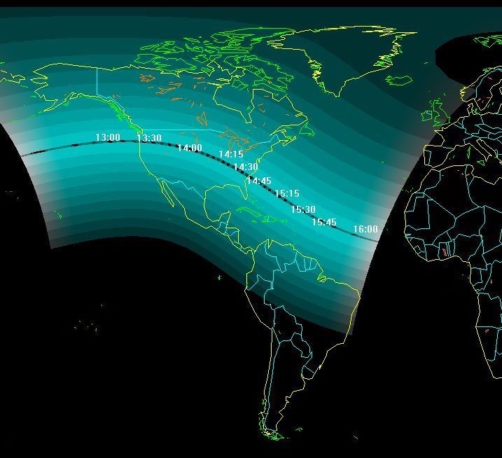
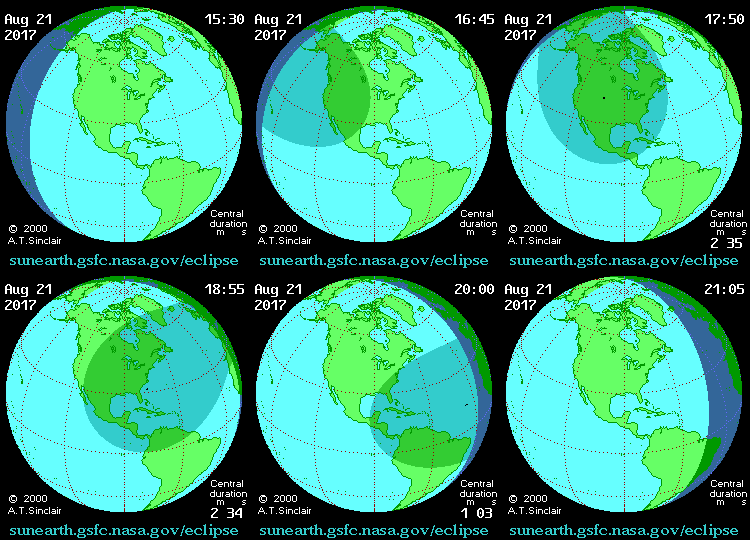
This map shows the entire path
and coverage of
the eclipse. Only observers in locations under the
dark curved bar will experience a total eclipse. Those in areas
above or below this bar will see some
degree of partial eclipse.
This map shows more detail. Only those locations under the dark horizontal bar
marking the path of totality will experience a
total eclipse.
Times shown are in EDT (Eastern Daylight Time). The further you observe
from the line of totality, less Sun will be covered by the Moon.
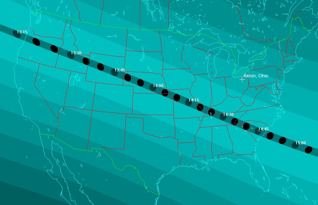
The path of totality will begin in the west and move eastward at over
1700mph(!) through these states (times shown are EDT).
Oregon, Idaho, Wyoming, Nebraska, Missouri, Illinois, Kentucky,
Tennessee, Georgia and South Carolina.
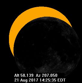
From the location of the ACA Observatory, a partial eclipse with maximum coverage of the Sun at
approximately 2:32pm will be seen as indicated in the graphic below
created from
this Website. Please note that the times shown in the graphic
are in UT (Universal Time).
To calculate EDT (Eastern Daylight
Time) from UT, subtract 4 hours from the
times shown (ie. 18:31:57.5 UT - 4 hours = 14:31:57.5 EDT
= 2:31:57.5 PM EDT)
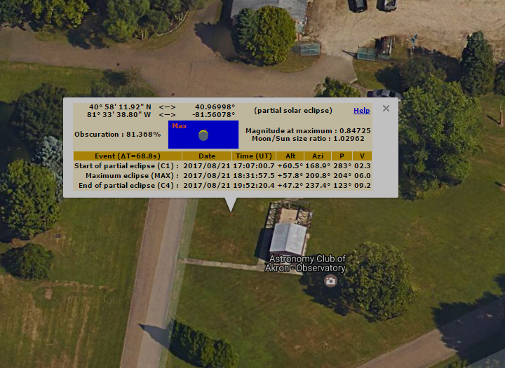
Here's the information converted to Eastern Daylight Time:
Event
(as seen from the ACA
Observatory) |
Date |
Time
Eastern Daylight Time |
Alt |
AZ |
| Start of partial
eclipse (C1) |
Aug 21, 2017 |
1:07:00.7 EDT |
+60.5° |
168.9° |
| Maximum eclipse
(81.368% covered) |
Aug 21, 2017 |
2:31:57.5 EDT |
+57.8° |
209.8° |
| End of partial
eclipse (C4) |
Aug 21, 2017 |
3:52:20.4 EDT |
+47.2° |
237.4° |
Click the graphic below to see a
computer-generated animation of the
eclipse we'll see from northeast Ohio.
|